3
DayZ maps covered
ZLocator is a DayZ location finder — a map app that answers one question: where am I? Point your phone or tablet at the screen and it recognizes the terrain in front of you — then names the town you're next to, marks your position on the Chernarus, Livonia or Sakhal map, and shows which way you're facing.
Out now on Google Play and the App Store. Works with Switch 2, PC, PlayStation and Xbox — nothing is installed on the console, and no server mod is needed.
Nasdara is coming to ZLocator. DayZ Badlands brings Nasdara, the largest official DayZ map, on 15 October. We start mapping it the day it comes out. Until then the app covers Chernarus, Livonia and Sakhal.
The Badlands map →No capture card, no second account, no overlay. Prop the phone or tablet where it can see the picture, and leave it running while you play.
Put the tablet in a stand where it sees the whole picture. The detector finds the TV for you, or you place the four corners by hand; press Lock and that's your frame. Tracking won't start before it is, and once locked the device has to stay exactly where it is.
Ridge lines, road bends, a rusted sign in Cyrillic — the match runs against a million reference views of the map.
A marker on the map, the direction you're facing, and the name of the town you're next to — plus the nearest well, shop or military zone from the map data. Road signs and landmarks are read along the way to confirm the fix.
A tablet in landscape is what this is built for: the map gets the room, the camera preview stays small enough to ignore, and the last fixes stay on screen so you can watch the position settle. On a phone the same panels fold away so the map keeps the screen.
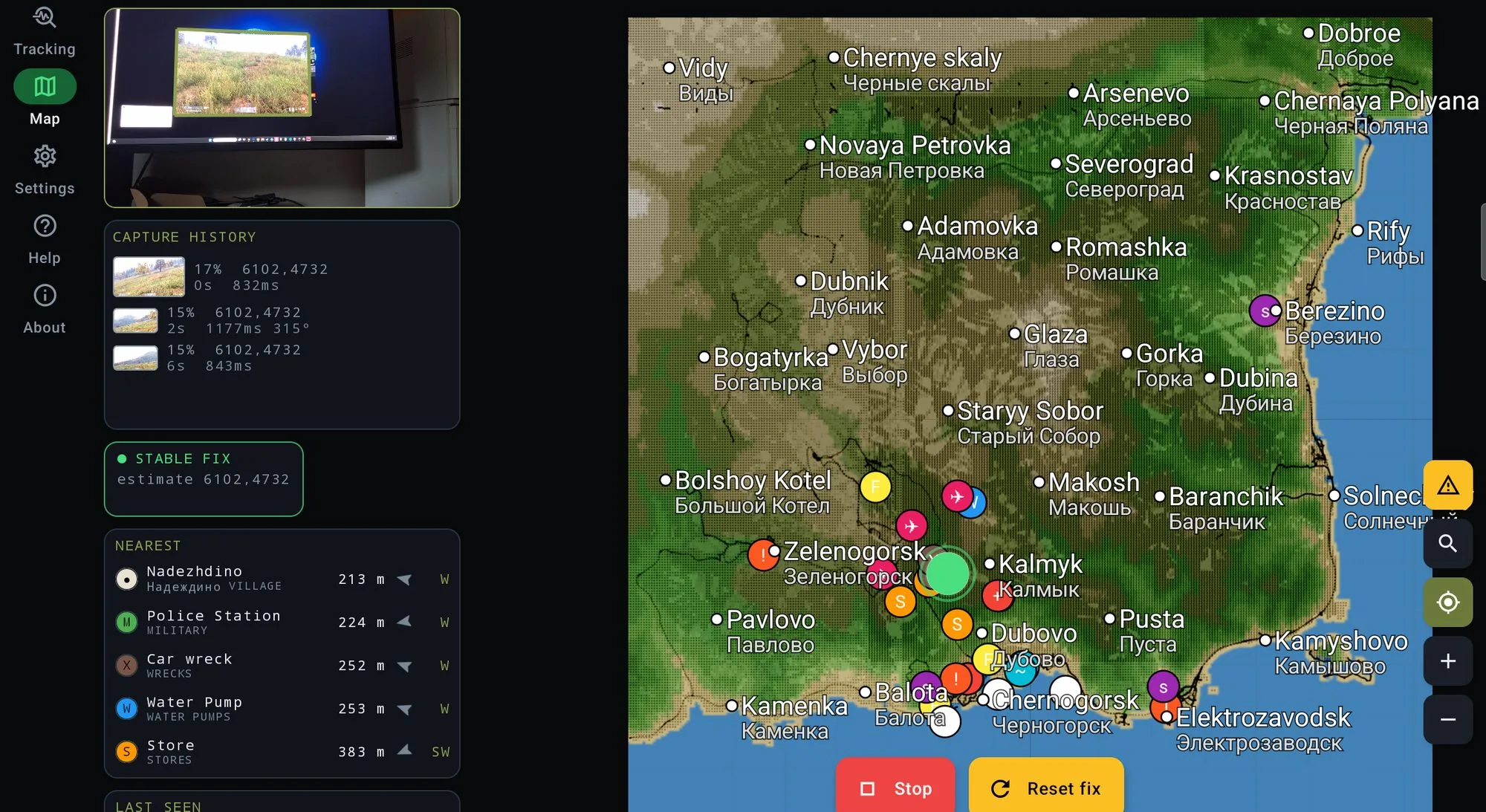
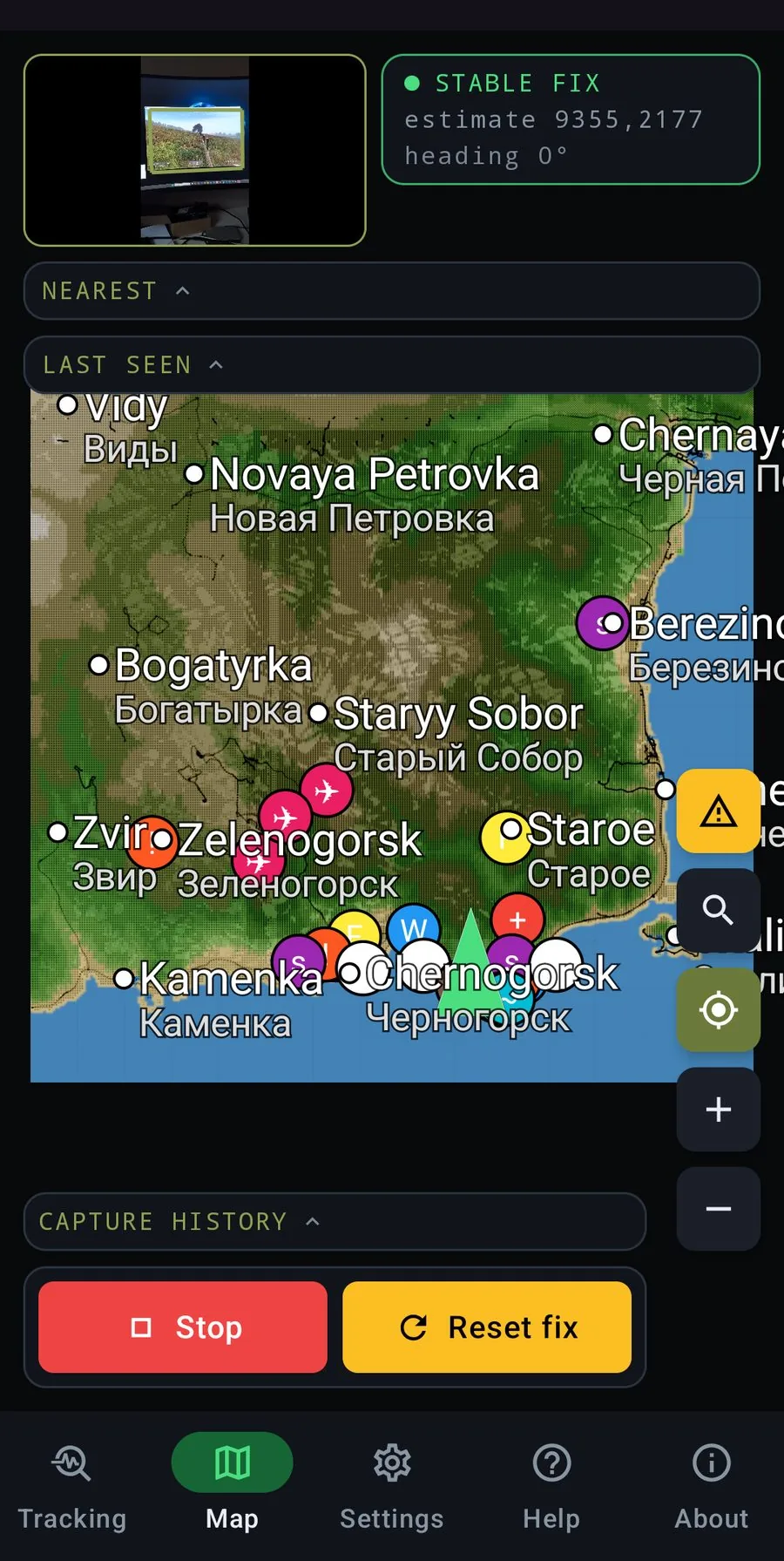
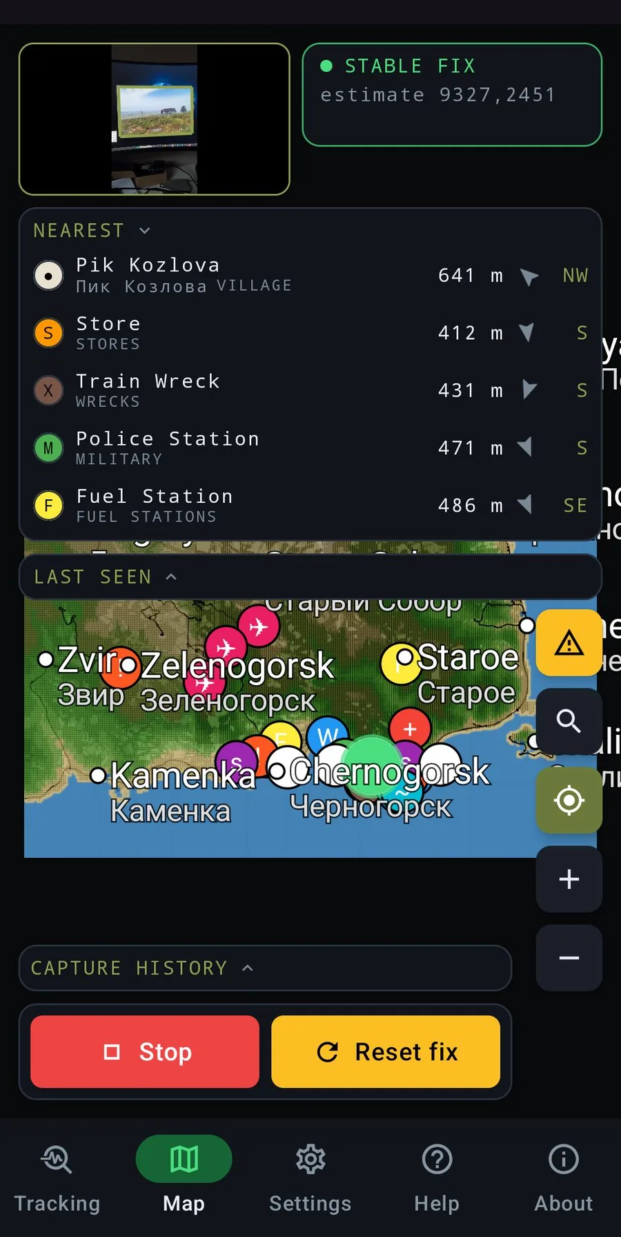
Four steps, all of them running while you play. No capture card, no overlay, nothing installed on the machine you play on.
Before anything else you lock a frame. In the camera view the detector looks for the TV about five times a second while you aim, or you place the four corners by hand — then Lock stores that quad and the detector stops. From then on you're in the map view, and every three seconds one capture is cropped and squared with that locked frame and sent off to be matched. That's why the tablet sits in a stand: move it and the frame has to be set again.
A vision model compresses that picture into a few hundred numbers describing the shape of the place: ridge lines, the run of a treeline, the bend of a road, the silhouette of a building. Not pixels — structure.
We walked every terrain in-game and photographed it from every angle, ending up with around a million reference views for Chernarus alone. Your fingerprint is compared against all of them in milliseconds, and the closest candidates come back with the coordinates they were taken at.
The candidates from several seconds of frames are pooled, weighted by how recent they are, and checked against how fast a person can actually walk — so a match 4 km away is rejected rather than drawn. Road signs are read separately, and a legible town name can override a weak visual guess outright.
None of this touches the game. The reference views and the map tiles are our own, captured by walking the terrain. Place names come from the game's own data — and no game files are shipped in the app.
Each terrain was walked in-game and photographed from every angle. Coverage is not uniform — the areas people actually play through are the strongest, and the emptiest corners are the thinnest.
These came out of the same walk as the terrain, and their positions are exact. Once your own marker is in the right place, so is the distance to every one of them.
Install the app and the whole map is yours — every town, well and military zone, offline, with no account and no time limit. The subscription buys one thing: the app working out where you are and putting you on it. Both paid plans start with a 3-day free trial and renew automatically unless you cancel before it ends. Billing goes through Google Play or the App Store — nothing is sold on this page, and you cancel from your store account whenever you like.
The whole map, offline. Towns, wells, military, place names and distances. No account, no time limit. You just have to know where you are.
Starts with 3 days free. Cancel before they end and you pay nothing.
Ten months' price for twelve. Also starts with 3 days free.
One subscription covers Chernarus, Livonia and Sakhal — and every DayZ map we add later.
Recognition works off what's on screen, so what you point the character at decides how fast the fix lands. This is the honest version — how it actually behaves, not how we'd like it to.
That's the promise, and it's the one thing worth having when you're lost. The rest we'd rather under-sell than over-claim. Everything else on the map — every well, town, hospital and military zone — sits at a position we captured and know exactly. There is only one uncertainty in the whole app, and it's your own dot. Get that right and everything the map tells you around it is right too.
A frame goes out roughly every three seconds. The first ones land wide — one patch of forest looks much like every other patch.
Consecutive frames are cross-checked against each other and against walking speed, so the marker settles instead of jumping. Half a minute to two minutes of walking is typical. Standing still does not get you there, not even in the open.
Once locked, it tracks as you move. If it drifts, the fastest repair is a road sign — see below.
Short version: keep walking, and read a sign when you can. If the marker looks wrong, don't stand and wait — walk thirty seconds along a road, or find a sign and face it. That fixes it faster than anything else you can do.
Stuck on the wrong place? Press Reset. It throws the lock away and starts recognition from a blank slate — faster than waiting for a bad fix to talk itself round.
Not in the game — DayZ ships without one, and an in-game paper map is a rare find. ZLocator is a map locator you run beside the game: the map of Chernarus, Livonia or Sakhal is in the app, and your own position is drawn on it while you play.
Point the phone or tablet at the screen and keep walking. The app matches the terrain you're looking at against a million reference views of the map, then names the town you're next to and shows which way you're facing. A readable road sign is the fastest way to settle it.
The map is. Install the app and you can pan around Chernarus, Livonia and Sakhal, read the place names and see every well, military zone and hospital — offline, without an account, for as long as you like. What you pay for is the part that’s hard: the app looking at your screen and working out which of those places you’re standing in. That starts with a 3-day free trial.
Yes. ZLocator reads a screen, not a game — it doesn't care whether the picture is live or a screenshot a friend sent you. Open the image on any screen you have, a monitor, a TV or a second phone, and point the camera at it the same way. The bigger and brighter the screen, the better it reads. Daylight scenes with buildings or a coastline in view are the easiest; a dark forest is the hardest.
Chernarus, Livonia and Sakhal. Nasdara, the new map in DayZ Badlands, comes out on 15 October, and we start mapping it that day. One subscription covers every map, including the ones we add later.
Yes — and on PC, PlayStation and Xbox. ZLocator doesn't care what's driving the screen, only what's on it. Handheld mode works too if the phone can see the display clearly.
Accurate enough to name the town you're next to and pick the right road out of it — we don't publish a metre figure, because the honest answer depends on where you are. The first lock usually takes half a minute to two minutes of walking. Deep forest and standing still are the hard cases; a road, a coastline, a landmark or a readable sign is what settles it. It needs game daylight.
No. The in-game GPS receiver, tourist map and compass are rare finds, need batteries and are usually the first things you lose. ZLocator works with none of them — it reads the picture on your screen, so it works from the first minute of a fresh spawn.
Those are marker maps: excellent maps, but you have to know where you are before you can use them — the usual advice is to find a road sign, read the town name and look it up by hand. ZLocator does that step for you. It recognizes the terrain and puts your marker on the map, which also means it works on console, where no map mod can run.
Yes, for the recognition itself — the matching runs on our servers. The map you look at is stored on the device, so panning and zooming stays smooth even on a bad connection.
Only what is inside the frame you locked. The game picture is straightened and scaled down on the device before anything leaves it — the rest of the camera view, your room included, is cropped away and never sent. What travels with it is the picture, an app-generated device id and the position estimate, so the next fix knows where you were three seconds ago.
A tablet in a stand, in landscape, is the setup this is built for — the map gets the room it deserves and the locked frame stays put. A phone works, but it needs a stand just the same: once the frame is locked, a device that moves has to be framed again.
Yes — ZLocator is on the App Store for iPhone and iPad, and on Google Play for Android. The same subscription does not carry across stores: each store bills separately, so buy it in the store you use. A tablet in a stand is the setup it was designed around, on either platform.
Free for the first 3 days. Every DayZ map included.